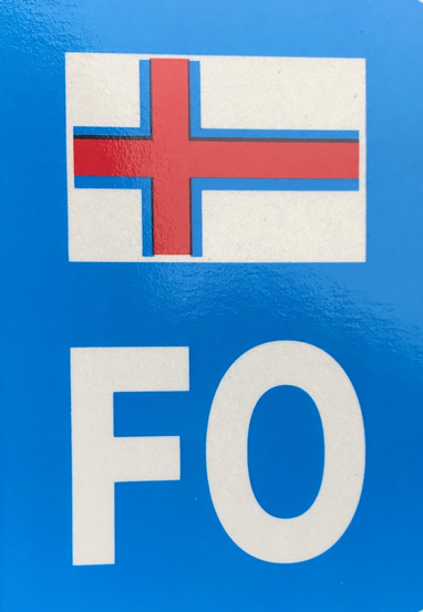
Sunday 23 July 2017

Faroe Islands - 2

FÆRØERNE - 2
FAROE ISLANDS - 2
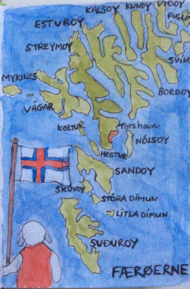
Monday 10th - Wednesday 19th June 2017


More of Lucy's adventures on the Faroe Islands

For the second part of the Faroe adventure I bought a   travel card so that I could hop on and off public transport and explore further afield. In total Lucy visited eleven of the eighteen island travelling  on buses, ferries, small boats and on foot,  She sat on the  most northerly point knowing that there was nothing between her and the Arctic. Minibuses on the smaller islands connect with the two main bus routes and ferries and the driver phones through to say you are on board and waits until the bus or ferry arrives. The Faroese have an obsession with tunnel building and aim to link all the islands. Some of them are wide new tunnels over 6 km long on the sea bed between islands and others are dark single track ones with passing places cutting through the mountains. They are currently building a new one under the sea from Streymoy to Esturoy which will have a roundabout in the middle of it. One day Lucy had the front seat on a bus and this was her view as we went through one of the new tunnels. 


Lucy went for a Hike


All the guide books give details of hikes across the islands  to look at birds, light houses,  coves, cliffs, little villages or historical sites and I did two or three of the easier ones. One day I got the bus to Kirkjubøur, the site of St Magnus Cathedral built around 1300 from rock and stone, and then walked back across the hillside climbing to a height of 600 metres from sea level and back down to Tórshavn. Lucy went on ahead while I looked at the ruins of the church and the village. She waited for me on a chair made of rocks that  has marked a meeting place for national speeches and patriotic songs since the 1800s.


It was about ten miles and the path was very steep and rocky and quite difficult to find at times. Although it was listed as an easy hike, it was just about my limit, but the views were fabulous and well worth the effort. 

The English invade Tórshavn 

I had only met five or six English people since I arrived here, so it was a surprise when I walked through the Tinganes to find it swarming with English as there was a cruise ship in town. I chatted to a couple of sisters and learnt that they were only here for two or three hours and this was their second stop since they had left Tilbury Docks and they were going to Iceland that night. As it was a Sunday most places were shut, so they were crowded in one of the few cafes that was open. The restaurants open at four on a Sunday but they were well gone by then. It was a bit embarrassing as a lot of them were moaning about the prices and one man said, "I usually do. Mediterranean Cruises, this isn't the same is it?" Someone else asked how far it was to the art gallery and the reply was that as the town buses don't run on Sundays they would just have time to get there, run  round it and back before their ship left.

Listasavn Fóroya (Art Gallery)


I spent a very wet Saturday in  the Art Gallery. Because the Islands are so isolated the artists were not influenced by other European schools of art and developed independently, mainly painting local scenes, portraits and the islands. 


Nólsoy painted by Stefan Danielsen ((1922-97) who spent most of his life on this island where he was born.

Churches and Church Art

The Lutheran church is very strong and powerful on the islands and the churches are in perfect condition. There are small ones  in every village, often on a headland overlooking the sea that have been rebuilt on the same spot over hundreds of years, 


This church is on the most northerly point at Viðareiði om the island of Viðoy and contains a collection of altar silverware donated by the British government to thank islanders for their hospitality after a British brig was wrecked in 1847. 


There are also several  beautiful modern churches in the towns like the Vesturkirkja in Tórshavn with a copper tower built in the form of a pyramid, which caused much controversy when it was built in 1975. Being Lutheran they are very plain inside mostly painted white with a fabulous altar painting and often a boat hanging from the ceiling to remember lives lost in sea tradgedies. I chatted to someone from the church in Klalsvik and he invited me to look at the wonderful circular, wood relief plaques in a meeting room downstairs. There were ten in all telling the story of Christ. 


More church art was on display in the National Museum and the fabulous very early carved pew ends were described as the 'jewels' of the islands. I took so many photos of these and it is difficult to decide which one to include here. But I have chosen the meeting of the Virgin Mary and Elizabeth. 


The cliffs at Vestmanna

I had to wear a hard hat but Lucy sailed around and into the vertical free-standing cliffs wearing her Viking helmet and imagining that she was one of the first people to see these 600 metre high cliffs which are the nesting place for thousands of birds. As we sailed along the base of the cliffs we saw puffins and razorbills and went behind the cliffs and into dark grottos. 


It was a two hour boat trip and was fairly choppy when we returned across open water to Vestmanna. The woman next to me threw up over the side of the boat but luckily it didn't blow onto me. 


Krígssavnið (War Museum)

When Lucy visited the Krígssavnið on Vágar she met Robert Shrive, who was visiting from England. His father was stationed on the island during WW2 and married a Faroese bride. Robert was with his Faroese cousin and although he grew up in England he spent his holidays on the Islands and kept in contact with his Faroese relatives. I had a coffee with the two men and they told me some interesting stories about their family. The photograph below shows Robert"s father and grandfather during the war.


The Faroes were occupied by Britain from 1940 after Germany invaded Denmark and at one point there were 8,000 British troops on Vágar and 2,000 local inhabitants. While they were there the British troops  drove on the left and built an airport. This is still the International airport which is about 30 miles from Tórshavn and on a different island. Until the new tunnel was built everyone arriving from overseas had to make a ferry crossing to get to the capital.

Noðlandahúsid, The Nordic Centre


This was a great place to spend a wet day, to have lunch (they do a really good buffet brunch, brunj) and catch up on emails as there was good wifi coverage.  It is an arts centre, a bit like the mac in Birmingham, with a gallery, cafe, theatre, dance studio and activity rooms. The stone entrance is Norwegian, the chairs are Finnish, the wooden walls are Swedish, the glass and steel are Danish, the roof construction is Icelandic and the grass roof is Faroese.


Lucy's last day in Tórshavn 

I spent the day walking around Tórshavn and  climbed up to the Western side of the town where there are some fabulous houses dating from the late 1800s. 
There is also a little botanical garden with 148 species of flora found on the Islands including viviparous sheeps fescue. Although there are no native trees on the Faroes the islanders,especially in Tórshavn, plant trees in the town and are very proud of their gardens. Tora who owned the annex where I stayed frequently watered her garden with a hose, even after a day of rain.


While I was doing this Lucy gathered up herFaroese  memorabilia and went off to post it home. She was very pleased that she found the budget shop (sheep) and bought envelopes and other things at a fraction of the price that I had previously paid. 


So Lucy's three week stay on these amazing Islands came  to an end and she sailed to Iceland  to start another stage of her Grand Viking Tour. 


Monday 17 July 2017

Faroe Islands -1

FÆRØERNE - 1
FAROE ISLANDS - 1
Thursday 29th June - Sunday 9th June 2017


On the ferry Lucy realised that she could watch the live feed of the ship's progress on the television in the cabin, so while I braved the elements on deck to watch the sunset/sunrise Lucy stayed in the cabin as she didn't want to get blown away. There were a lot of people on deck 8 sitting in the hot tubs as we travelled through the night and in the morning I joined a group of people watching the gannets flying over the boat.


I was the only cyclist to get off the ferry when it docked at Thórshavn (pronounced Toe-ush-hawn) as all the  motorcyclists and the four or five other cyclists were continuing to Iceland, so I was first off into the drizzle. I pushed my bike up what seemed like a mountain wondering if I was doing the right thing stopping here as there won't be another ferry until this time next week. I had booked a small room at a B&B with shared lounge, kitchen and bathroom, but when I arrived she offered me an annex at the side of the house for the same price. I jumped at the chance as it isn't a lot more expensive than staying at a hostel. It is a bit ramshackled, and was probably a granny flat that hasn't been used for a while. It still has some personal possessions and a fair bit of junk piled up behind curtained-off areas, but I have my own front door, a kitchen, shower, and a very nice bedroom. And a hallway to keep my bike, perfect. 


The next day I explored Tórshavn and found out that there is hardly a flat area anywhere on the islands which all rise steeply from the sea. I also discovered that as Tórshavn  is central you can travel by bus and ferry to most places  and back in a day. The plan had been to cycle to different islands but I decided to give the bike a rest for three weeks and have a holiday here. I managed to negotiate a price at my Granny Flat and I am  enjoying the freedom and really feel at home. It overlooks the Island of Nórsoy, which I love, and this photo was taken from my window at about 11.30pm. I don't  think it is getting dark at the moment.


 A fjord on Esturoy


As I am not doing much cycling here I won't do a daily account of Lucy's travels but will just describe some of the things that she has done and give  a few facts about the Islands. The family who live at the B&B run the Island Tour business and invited Lucy to go on a free excursion, including an excellent lunch on the second day. Luckily they invited me as well. It was a really good introduction to the islands, and we travelled into the mountains, along fjords and through tunnels to Estturoy. There were only 10 of us, Lucy, me and two people from Denmark, Sweden, Russia and Israel. It was all very laid-back and we had about 30 minutes to wander about at each stop. The list price for the tour is 890 KR, which is about £105 so we did well. The Faroes have their own currency and bank notes, the króna which has the same value as the Danish krone.


Lucy's first impressions

Lucy loves the sheep which out number the people by at least 2:1 and has spent a lot of time talking to them learning  about the history and culture of the Islands.  She also likes the fact that the Vikings from Norway were the first people to inhabit them, although it is possible that Irish monks arrived before them. She has also enjoyed the museums, the ferries and like me loves sitting watching the sea. 


The first thing that struck me was that it is very clean and fresh. The  green grass almost hurts your eyes, the skies are fabulous and are constantly changing along with the weather. You can sit for an hour and the clouds and sea change, sometimes two or three times. 


The Islands are in the Gulf Stream so have a maritime climate and at no point are you more than 3 miles from the sea. It can be very wet and windy and gales can rage for days in the winter cutting off the more remote districts. The average winter temperature is about 3 degrees and between 10 and 12 in the Summer. It is very hilly, wild and desolate, there are no trees and no indigenous animals, but up to 300 different species of birds either live on or visit the islands. The  roads wind steeply up from the sea often with several hair pin bends and then drop abruptly down to the next fjord and at no time are you more than 3 miles from the sea.

The Islands 


The archipelago with a population that has just topped 50,000 this year is composed of 18 islands formed from layers of basalt laid down by volcanoes and cut by glaciers, Since they gained Home Rule in 1948 they have been a  self-governed region of the kingdom of Denmark although they are not in the EU. There are 33 MPs in the Faroese Parliament and the everyday language spoken by the islanders, and the language of education and government is Faroese, which is closely related to the ancient Norse language of theVikings and wasn't a written language until 1823. Islanders also speak Danish and most of them speak English. The majority of tourists here are from other Nordic and Scandinavian countries and the common language for communication is English. Interestingly they say that they find people from England harder to understand than the English spoken by Northern Europeans. 


They have rebuilt their economy after the crash in the 1990s when a lot of businesses folded and they were bailed out by Denmark. They pay no direct taxes to Denmark and receive 14% of their GDP in subsidies. Education, health care and care for the elderly are free. People from Nordic countries are covered by their respective public health plans while visiting the islands, and surprisingly UK citizens are covered by the NHS.

Tórshavn and the Tinganes


Torshavn, on the Island of Streymoy, has a population of about 20,000 and is the smallest capital city in Europe. Its brightly coloured buildings sit alongside the traditional black tarred houses with grass roofs and rises up the hillside from the harbour. Grassed roof  dwellings are found throughout the islands, both on old village dwellings  and on large modern buildings in towns. 


The Tinganes, is where the red, wooden government buildings are situated on a small headland between the two harbours on  the site of the early Viking Ting. The buildings are closely packed and linked by steep narrow lanes. The photo shows Lucy sitting outside the office of the Minister for Finance. 


have taken the above information from locally produced publications and from what I have been told by local people. A young man at the Akvarium gave me a very interesting booklet of up-to-date statistics. He is leaving soon, as most young people do, to complete his education in Denmark. He told me that many don't return and there are approximately 20,000 Faroese living in Denmark. This creates a problem for the Islands  and the government are trying to encourage more to return. I also met the leader of the Woman's Organisation and she told me how far behind they are in terms of equality compared to Denmark and other Nordic countries. They have recently reformed the law governing prosecution for rape and gay marriage was legalised in December last year. According to one book that I read the fertility rate is the highest in Europe with a birth rate of 2.9 per woman. It also has the lowest divorce and abortion rate compared to other Nordic countries.


So, I have spend my first ten days getting to know the country and meeting some of the people. I have also sat in cafes, walked along the coast, hiked over land, visited several islands, and been to museums, the art gallery, and found out about the culture of the Islands. I could write a lot more but don't want to bore people so have just givenn snippets of information. When she visited the history museum  Lucy was horrified to read that the last three of the early breed of Faroese sheep introduced by the Vikings were shot on the island of Litla Dímun and stuffed. They are in the museum and Lucy made sure that she didn't visit that island.


It is hard to believe that I am halfway through my stay and there is still such a lot that I want to see and do while I am in this fabulous, very different, remote country. I am leaving for Iceland on the 19th and will post the second half of Lucy's, Faroese adventures after I arrive there on the 20th. As before I will not be in email contact with people while I am on the ferry.  


Thursday 6 July 2017

Denmark - 3

DENMARK - 3
North Jutland Coast - Thursday 22nd - Tuesday 26th June 2017


The plan was to start cycling North from Frederikshavn and follow the coast to Skagen, the most northerly town in Denmark and then along the North coast to Hirtshals to get the ferry to the Faroe Islands next Tuesday.  Lucy had been reading about the numerous bunkers remaining from WW2  dotted around the coast and she became engrossed in the history of North Jutland. Legoland was totally forgotten, at least for this stage of the journey 


 So, as it was only midday when the ferry docked, I cycled South to find the Bangsbo Fort Bunker Museum, high on a cliff top and learn more about them. Part of the fort is still used by the Danish navy and there were several restricted areas.


There are two seas around the coast of N. Denmark,  The Skatterak between Denmark and Norway and the Kattegat between Denmark and Sweden. They  are the gateway from the North Atlantic to the Baltic Sea, so it was important for the Germans in Denmark to defend the coastline. Later during the Cold War more bunkers were erected by the Danes and used by the Danish military. 


I cycled back to Frederikshavn and found somewhere to stay and continued on my planned route to Skagen on Friday morning. The above photo was taken from my window at about 11.30 pm. 

The cycle path to Skagen - Friday 23rd June 

Heavy rain was forecast for the afternoon so I had an early breakfast and got on my way. The cycle path was very easy to follow and led  me on paths directly to Skagen through pine forests and sand dunes. 


I stopped for lunch at a 'Primitive Campsite' in a clearing in a wood. It is illegal to pitch a tent anywhere in Denmark that is not an official camp site, so wild camping is not allowed. But in Jutland there are 'Primitive campsites run by the Naturstyrelsen, where you can pitch a tent for one night, then you have to move on. They have an area to light fires, some times there is a tap and covered shelters where you can sleep. But there are no toilet facilities. 


I also planned to stop at the Tilsandede Kirke (the sand covered church) but as rain was threatening I decided to carry on. So glad I did because it tipped down about 200 metres from my destination. I checked in and wandered around the town, discovered the church and spent the evening at the harbour. 


Skagen is a popular tourist town and was home to a colony of artists in the late 1800s known as the Skagen Painters. I can see why they congregated there as the light, the buildings and the seascapes are all fabulous. All the buildings are painted yellow, with white window frames and terracotta roofs. Beautiful. 


As well as the expensive yachts, Skagen is a working harbour and is the main fishing port in Denmark, so there were a lot of large boats to be seen.

Lucy's Weekend in Skagen - Saturday 24th and Sunday 25th June


Mid-Summer's Eve and Day are the biggest Public Holiday of the year in Sweden, and people were busy getting ready for it when I left. It isn't celebrated in Denmark, but marks the beginning of the holiday period, so everywhere has suddenly become a lot busier with Danish, Swedish and German tourists. I have only met 3 English people so far this trip and one of them was a very drunk guy last night. He was staggering about and jumping onto the biggest yachts in the harbour and was either thrown off or he crawled off. Oh to be English on holiday!

Hvor de to have mødes  - Where two seas meet


Lucy!s plan for the day was to go to the furthest point North in Denmark. This is where thr Skatterak Sea and the Kattegat meet. I wasn't sure whether to cycle there or get the bus, but Lucy wanted to walk. She took me on a fabulous route along the sea shore and past lots of bunkers, some buried in the sand. Finally we arrived at the meeting of the seas, it was breathtaking and you could see the line where the more gentle Kattegat met a raging Skatterak. You could wade out a bit and stand with one foot in each sea, quite a magical experience. And just to prove that I really am on this trip, here is a rare selfie.


Lucy rushed off and sneaked a ride on the tractor bus that takes tourists along the sand. I decided to walk along the North coast, a great expanse of sand, dunes and sea. I had to keep stopping as I couldn't quite believe how vast and beautiful it was but was unable to capture it properly in a photograph.


I stopped to chat to a couple from Sweden who had somehow managed to ride their bikes there and then  found Lucy sitting amongst the sand dunes looking at the sea. 


That night I decided to treat myself to a meal in one of the harbour restaurants. By this time the wind had increased dramatically and was gusting at over 40 mph. All the restaurants were full inside so I joined the hardy Danes and sat outside wrapped in the blankets that were  provide. It was a great meal, but I have no idea how the food stayed on the plate.

Sunday in Skagen


I spent most of the day taking photographs of the fabulous buildings in Skagen and at the art gallery looking at the fine collection of works by the Skagen Painters. I particularly liked the special exhibition of current work by a Swedish artist, Jacob Rantzau, who was inspired by the 1884 painting 'Launching the Boat' by Oscar Björack. 


Rantzau worked on his project between 2013 & 2015 and hundreds of his sketches were displayed as well as the finished works. 


One of his larger sketches which in many ways I preferred to the final painting. Afterwards I had a late Sunday lunch and a final walk along the harbour. Lucy and  I really enjoyed our time in Skagen, it is a wonderful place. 

A Day to Remember - Monday 26th June 2017


I followed the cycle path West along the North Sea to Hirtshals where the ferry departs for the Faroe Islands. The sun was out all day, the sky was blue, and the cycle path wound through open countryside very close to the sea. It should have been idyllic,  BUT .... there was a 50 mph head wind all day. I think it is one of the toughest 46 miles that I have ever cycled. Luckily the route was off-road so there was no danger of being blown into any traffic, but it was hard to control the bike at times. 


I stopped to look at the sand covered church that I missed earlier. All that remains is the tower and there are posts to mark the outline of the church that is now buried beneath the sand. Lucy is sitting on one of the posts. I also stopped for lunch at another 'Primitive Campsite', right on the edge of the North Sea and made a detour to look at the sea.


At one point the path became so soft  that it was impossible to ride, but as I was pushing my bike a couple of locals came along and led me onto a quiet lane that took me the final 10 miles into Hirtshals. They said the path had been resurfaced and hadn't bedded in yet. 


I had to cycle near the ferry port and again I had to walk as the wind was side on and it was impossible to keep the bike upright. The sand was blowing in my face and I was praying that the storm would die down before I boarded for the 34 hour crossing in the morning. My face was stinging and I had sand in my hair, in my eyes, up my nose and in my ears and teeth. Definitely a day to remember. 

I am writing this in the Faroe Islands where they are very proud of their mobile phone coverage which reaches every part of even the remotest island, but I am unable to use it as they are not in the EU so cannot use my roaming package that gives me unlimited usage in the EU. The wifi coverage where I am staying is intermittent so I will only be able to post and email people occasionally during the next three weeks.